I don’t know why the golden half-dome of this summit has taunted me ever since I spotted it on the horizon of Pyrenean peaks in the Ariège. Its distinctive profile seemed to pop up everywhere I went. Rising up smoothly on one side, the dome breaks off abruptly where its eastern side has been chiselled away, no doubt by long-ago ice action.
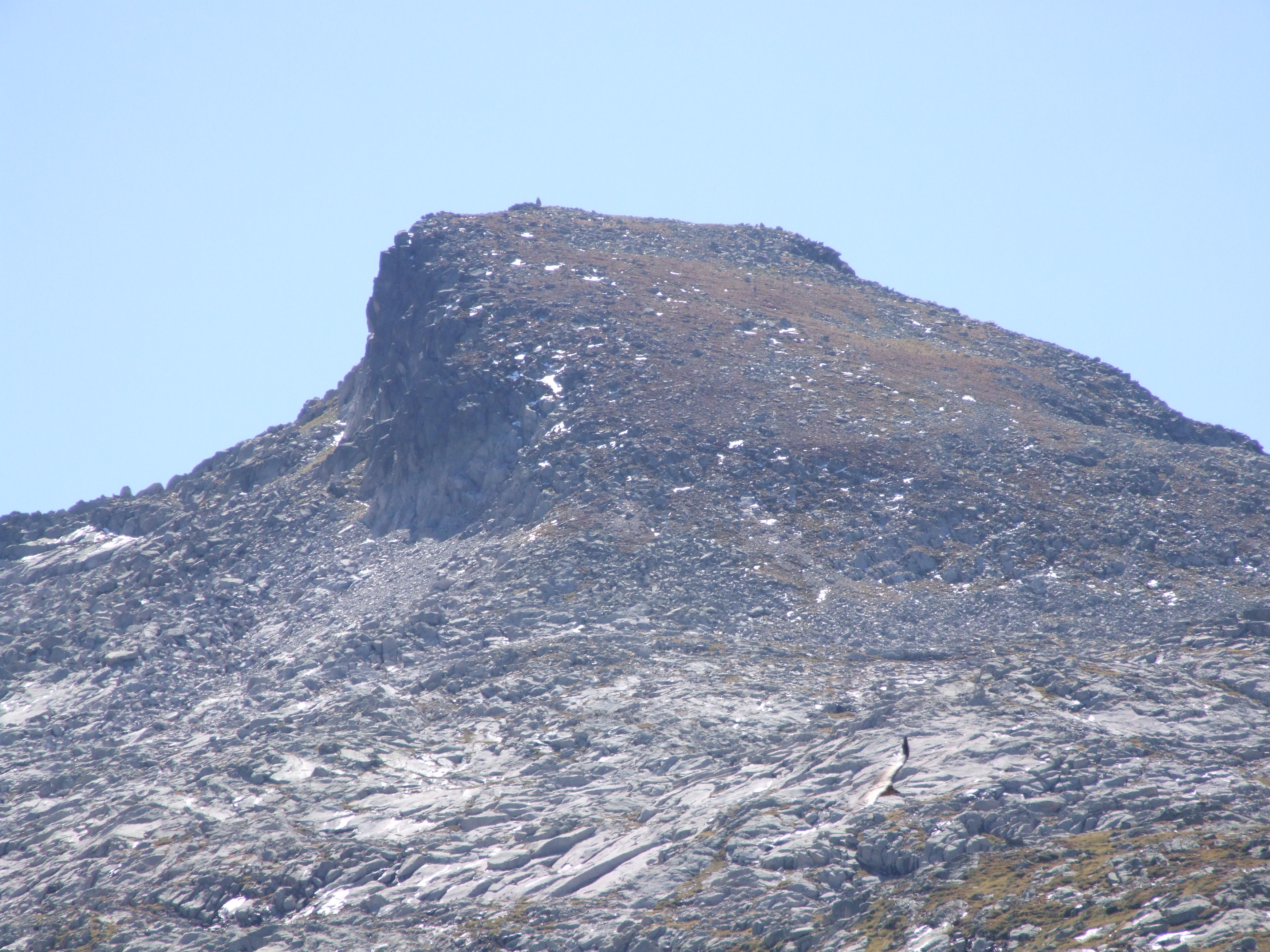
Walking through the woods in winter, I’d spotted it rearing up in white like a petrified breaking wave, the only hint that there was a mountain chain there at all. At 2676m it was higher than anything else I’d reached apart from Mont Valier, but it isn’t a technical climb, just a rollercoaster of a long, long ridge that rises and falls as it switches through changing terrain.

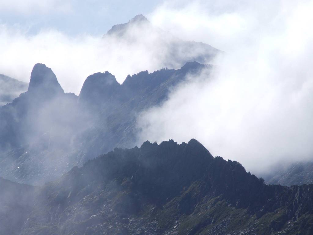

I’ve wanted to stand on that summit for years, although I’d turned back twice; once because the jagged teeth of the approach ridge looked too scary, and the second time when a large bank of cloud suddenly engulfed the summit dome, just as I was at its foot.
This October, seeing a window of clear, cool days, I set out to do it.
Parking at Coumebière (1400m), the round walk is about 15-16 miles with a height gain of 1276m, so it’s a very long day, with some tiring scrambling across a boulder field of pink-tinged rocks that give the peak its name.

From Coumebière follow signs to the étang de Labant, then climb up through the beech woods behind it to gain a small col on the ridge. Take a moment to enjoy the stupendous view over the Garbet Valley and the glacial cirques to the south, before turning left onto the uppermost path. Follow this path above the Garbet and eventually it turns left to rise steeply up to the main ridge that overlooks the Bassiès lakes. The destination summit is now visible in the far distance.
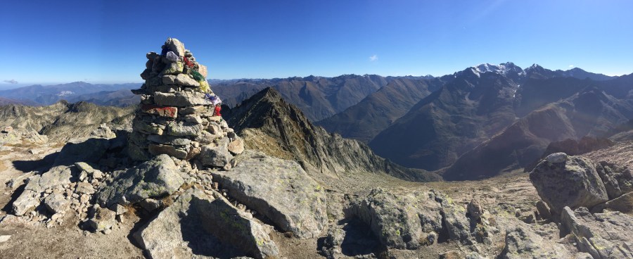
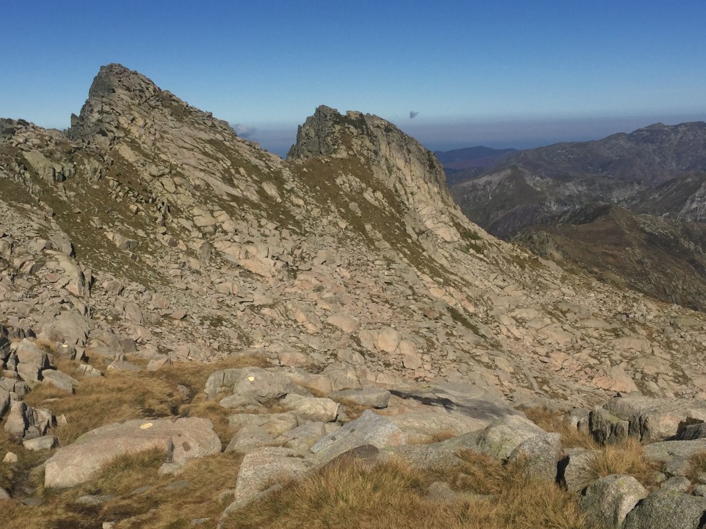
Follow the ridge path as it takes you over Pic des Planes and Cot de Morech, and then as the ridge becomes spiky with towering rocks, the path turns to the left of that crest, keeping below it. After an hour of scrambling over boulders – keep an eye open for the cairns and yellow markers – you’re at the foot of the summit dome. The path zig zags up steeply until suddenly, there’s the tall summit cairn ahead, and you’re looking across the other side to the Montcalm massif.
If you’ve ever walked to the etang du Garbet, you’ll recognise the craggy ridge of the surrounding cirque (with the distinctive notch of the couillade de Puntussan) down to the west, along with Puntussan itself and a glimpse of étang Bleu.

It was 5 hours up and 4 down for me, but I’m slow.
If you have the energy, some make it a round walk by diverting south beneath the ridge of Cabanatous with a stop at étang d’Alate. And for further inspiration, I highly recommend this Youtube video of the route, set to Xavier Rudd’s fabulous Spirit Bird. It certainly inspired me to persevere (although I passed on doing a summit handstand…)
For more details of the route and a map, try the Lone Peak Bagger‘s site.

